About Cedar Creek Golf Course
Renovated and reopened in late 2024, Cedar Creek is no ordinary golf course! This hidden gem, located north of Loop 1604 off Kyle Seale Parkway on the northwest side of San Antonio, offers a true Hill Country golf experience. Originally designed by Finger Dye Spann, Inc. and opened in 1989, Cedar Creek delivers a memorable and challenging round of golf with its rolling hills and stunning vistas.
Cedar Creek features dramatic elevation changes and strategic doglegs, creating a unique layout that accommodates all skill levels with four different tee boxes ranging from 5,500 to 7,100 yards. The firm and fast greens, each with at least two tiers, demand precision—make sure to pay attention to the flag locations, or you might find yourself begging for a two-putt if you end up on the wrong side!
Don’t worry if you score a bit higher than your handicap; Cedar Creek’s challenges are part of its charm. Embrace the test and take a moment to enjoy the breathtaking Hill Country views.
DID YOU KNOW?
The San Antonio Open is hosted annually at Cedar Creek Golf Course, which was also a former site for local U.S. Open qualifiers! This unique course may be tucked away in the San Antonio Hill Country, but it’s easily accessible from all parts of the city. Cedar Creek challenges even the best golfers to think strategically, with its elevation changes and narrow fairways. And the beautiful landscapes? They're just a bonus!
Golf Advisor says: "Cedar Creek Golf Course in San Antonio may be a muni, but it offers resort-quality golf."
Virtual Flyovers
Map / Directions
Course Map

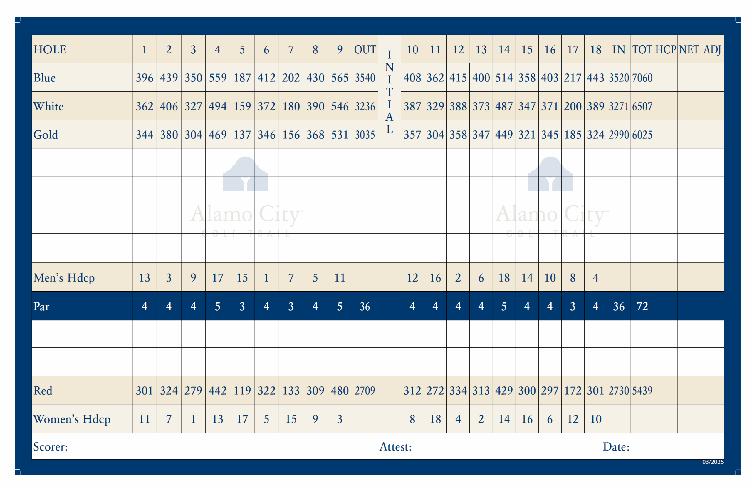
Course Scorecard